Thursday, October 27, 2005

Need for blink comparison software - Astronomical

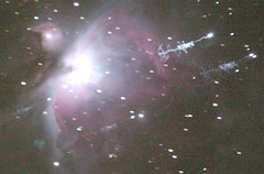
I searched the web for such a program, but came up short. What is needed is the ability to take two images, taken on different nights maybe with different instruments. Orientations and scale might vary. It's quite labor intensive to resize and rotate the two images by hand. Below is what I came up with (see Related links, below)

S.B.I.G. CCDBLINK Software: Allows blink comparison with ST-4 images on PC - will it auto-rotate? $99.00
-------------
MaxIm DL allows blink comparison of two images of the same stellar field. Once the two images are aligned and the intensities are matched correctly, any new or changed object shows up as a blinking object when the two images are swapped rapidly. - What a big nothing!

-------------
Graphical Astronomy and Image Analysis Tool ( GAIA )
GAIA is a graphical image display and analysis tool, it provides the usual facilities of image display tools, plus more astronomically useful ones such as aperture photometry, arbitrary region analysis, celestial co-ordinate readout, calibration and modification, grid overlays, blink comparison, defect patching and the ability to query on-line (WWW) catalogues.
.... "Celestial co-ordinates readout." ... under "Image Analysis Capabilities"
GAIA v2.7-3 This is a major release of GAIA incorporating two new automated astrometry toolboxes, a major re-write of the blink comparison toolbox and many changes and fixes.
GAIA now offers two new toolboxes based on the Starlink AUTOASTROM program. These make it possible to provide a minimum of positional information (image centre and scale) and then fit an astrometric solution. They also make it possible, for the first time, to fit optical distortions.
The blink comparison toolbox has been substantially upgraded in this release. New features are options to alignment to NDF origins or FITS CRPIX values. This gives much better behaviour when comparing images of different dimensions. Better performance (less flickering artifacts). The ability to drag images and enter image coordinate offsets. All images can now be viewed together or one-by-one as before. Images should now always scroll and the "Refresh" button has been removed.
------------
A related subject:
Determining coordinates - no easy way found, see http://groups.google.com/group/sci.astro.fits/browse_frm/thread/105fe7913d387aa5/c70cf7ece67e1a8a?lnk=st&q=%22determining+coordinates%22+astronomy&rnum=1&hl=en#c70cf7ece67e1a8a
-----
Related links -
Guide to Minor Body Astrometry http://cfa-www.harvard.edu/iau/info/Astrometry.html and http://cfa-www.harvard.edu/iau/info/Astrometry.html#equip
Accuracy of reference catalogs - http://www.fitsblink.net/astrometry/astrometry.html
Image Processing Resources for Astronomy Teachers http://www.phy.duke.edu/%7Ekolena/imagepro.
Astrometrica is a interactive software tool - html#ipAstrometrica is a interactive software tool
-------------------
'CHARON' ASTROMETRIC SOFTWARE

With Charon, one must provide an image, specifying either the object or an approximate position in the sky. Charon will then examine the image you've taken, and will search through a star catalog (such as the GSC and Tycho databases on the Guide CD-ROM) for stars covering that area. It then will calculate the transformation between J2000 RA/dec and positions in the image.

Once it has done this, it has registered the image to the sky, and will show you the image with GSC stars superimposed as an overlay. You can move the cursor around and collect information concerning the RA, declination and magnitude of objects in the image. You can hit Tab to immediately zoom in on the target object; Charon will show both the computed, "expected" position of the target object, as well as its actual observed position in the image, and the difference (observed - computed, or "O-C", or "residual") between them. http://www.projectpluto.com/charon.htm#description


Tuesday, October 25, 2005

The Space Elevator - my question is how will it be assembled and erected. How does one get the "seed cable" stretched into space?

The Space Elevator will be anchored to an offshore sea platform near the equator in the Pacific Ocean, and to a small counterweight in space at 100,000 km. Mechanical lifters (robotic elevator cars) will move up and down the ribbon, carrying such items as satellites, solar power systems, and eventually people into space. LiftPort's plan is to take the concept from the research laboratory to commercial development. Countdown to Lift: April 12, 2018 How erected? - see http://liftport.com/forums/showthread.php?t=242&highlight=erection WOW!

Russian scientist, Yuri Artsutanov, made a design in 1960.

"same studies estimate that the cost of sending payloads into space could be reduced from $20,000 per pound down to $400 per pound" http://liftport.com/faq.php

"Carbon nanotubes (CNT), discovered in 1991, are almost certainly strong enough. Theory says that they are 3-5 times as strong as we need them to be"

"We plan to build a second one immediately (using the first to make it much cheaper) and expect that the second will immediately be used to build a third, fourth, etc." http://liftport.com/faq1.php#basics2

Low Earth Orbit (LEO) objects can and will pose a serious problem. Active avoidance (moving the platform) can be used for objects that would cause damage. On average, an object would have to be avoided every 14 hours.

# How many climbers may be lifted at once?
With the current design, seven. One would lift off every day, with five tons of cargo. ... Then we stop everything, and then its all 'down'.

# Will the ribbon produce an electrical current?
The last space shuttle-tether experiment, which unspooled about 19 km of cable, generated thousands of volts of electrical potential and kilowatts of power, burned through the insulation of the cable, and generated a tremendous explosive arc of electricity, that snapped the tether. ... long answer at http://liftport.com/faq2.php#science2b


Tthe below manuscript is the result of a six-month investigation conducted for NASA under the NASA Institute for Advanced Concepts (NIAC) program. Even though this is the final report for that study, it is really just the beginning.
The study had the same simple title as this manuscript, The Space Elevator.
http://www.isr.us/Downloads/niac_pdf/chapter1.html

The initial "string" we deploy from orbit is actually a ribbon about 1 micron (0.00004 inches) thick, tapering from 5 cm (2 inches) at the Earth to 11.5 cm (4.5 inches) wide near the middle and has a total length of 55,000 miles (91,000 km). This ribbon cable and a couple large upper stage rockets will be loaded on to a handful of shuttles (7) and placed in low-Earth orbit. Once assembled in orbit the upper stage rockets will be used to take the cable up to geosynchronous orbitB&D where it will be deployed. As the spacecraft deploys the cable downward the spacecraft will be moved outward to a higher orbit to keep it stationary above a point on Earth (a bit of physics we will explain later). Eventually the end of the cable will reach Earth where it will be retrieved and anchored to a movable platform. http://www.isr.us/Downloads/niac_pdf/chapter1.html

Tuesday, October 11, 2005

War in Space? ... or camera malfunction (double exposure)? This is IMG_4497, now look at next photo in my photostream, IMG_4498


War in Space? ... or camera malfunction (double exposure)? This is IMG_4497, now look at next photo in my photostream, IMG_4498
Originally uploaded by edhiker.

Spent about two hours on this!
I took a series of pictures a few days ago and have been pondering one intently. It's at:
http://www.flickr.com/photos/edhiker/51350840

The answer is double exposure. I'm not sure how I did the double exposure with the Rebel, will have to ask the Canon people.

These cameras allow multiple exposures in-camera:
Fuji S3, Nikon D2X, Pentax *ist D
"One of the cool features of the D2X is that it allows the photographer to shoot multiple exposures and save it as a single image."

See corrected http://flickr.com/photos/edhiker/51350840
--------------
We are now seeing "all sky" coverage each month to about magnitude 19.0.
"All sky" amounts to something a bit over 10,000 square degrees. The
current surveys have a resolution of a few arcseconds, or about 10^6
resolution elements per square degree. That means "all sky" consists of
about 10^10 resolution elements. It turns out that we expect around one
asteroid per square degree in the sky to magnitude 19. Mostly these are
main belt, and of course the numbers peak up dramatically within 10 or so
degrees of the ecliptic, but averaged over the whole sky, one should expect
about 10,000 genuine asteroid detections per month. http://groups.yahoo.com/group/mpml/message/15781


In the middle region of the belt the density of asteroids was 160 asteroids larger than 1 kilometre per square degree.